Some Early Plant Depictions in Prehistoric Art

Although I’m interested in early art, formal art history either as books or lectures typically bores me to tears. Thankfully the Internet and open access allow me to dip in and out where and when my interests take me. Recently an article on some of the earliest plant images in prehistoric art caught my eye.

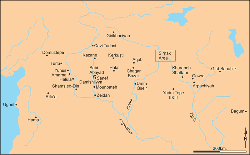
In their article “The Earliest Vegetal Motifs in Prehistoric Art” (in the December 05, 2025, issue of Journal of World Prehistory), authors Yosef Garfinkel and Sarah Krulwich note that systematic depictions first appear on painted pottery of the Halafian culture of northern Mesopotamia (roughly around the headwaters of Tigris and Euphrates) c. 6200-5500 BCE.

(They do later modify this statement with “this is one of the world’s earliest extensive uses of vegetal motifs, and the earliest in the Near East”, so I guess the jury is still out as to what is considered the earliest find we know of.)

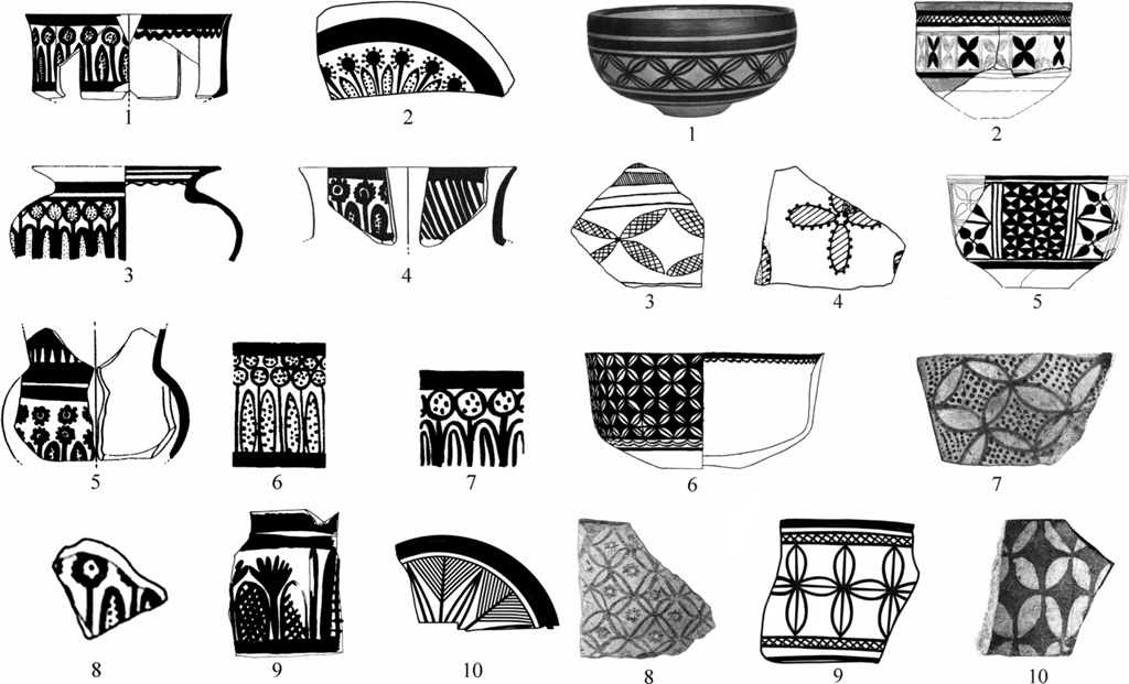
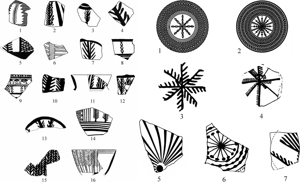
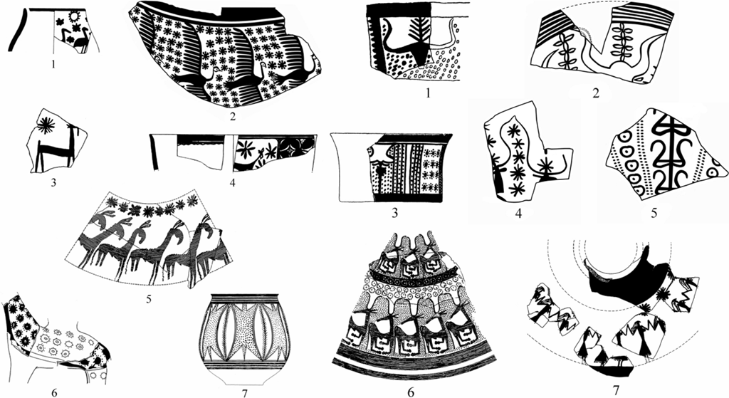
Garfinkel and Krulwich analyzed 29 Halafian sites and surveyed of one of the regions, for a total of several tens of thousands of painted pottery sherds with various motifs. The sherds mainly included geometric patterns, but also had depictions of animals, human figures, and plants.

Garfinkel Krulwich Map of Halafian Sites Sm
Map of the Near East showing the location of prehistoric Halafian sites, c. 6200-5500 BCE, in ancient Mesopotamia, as examined in Garfinkel and Krulwich’s survey (2025) of the earliest plant depictions in prehistoric art of the area.

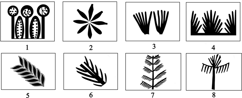
Among the plant imagery, Garfinkel and Krulwich focused on the ones identifiable “without hesitation”. They were able to classify the motifs into four basic categories: flowers, shrubs, branches, and trees.

Garfinkel Krulwich Classification of Plant Imagery Orig Sm
The classification of the Halafian vegetal motifs into four basic categories according to Garfinkel and Krulwich (2025): 1–2 flowers, 3–4 shrubs, 5–6 branches, 7–8 trees.

Apparently, botanical motifs were used in almost all sites and were fairly popular.

Garfinkel Krulwich Imgs 3and5 Mashup
Collage of images 3 and 5 in Garfinkel and Krulwich (2025): examples of flowers.

Despite the fact that each site only contained a small number of sherds with botanic imagery, a meta-analysis yields interesting results. Presumably the average frequency of plant motifs on decorated sherds is around 4-6 %, and they could perhaps relate to aesthetics (instead of religious rites, for example) and to the advance of mathematical knowledge, Garfinkel and Krulwich suggest.

Garfinkel Krulwich Imgs 14and18 Mashup
Collage of images 14 and 18 in Garfinkel and Krulwich (2025): examples of shrubs and branches.

Whole trees are apparently the least common motif among this sample. (I suspect I would initially be hard-pressed to recognize some of these trees as trees, having grown up with very different flora.)

Garfinkel Krulwich Img20
Image 20 in Garfinkel and Krulwich (2025): examples of trees.

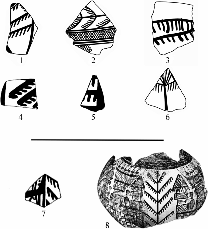
Some items came with two different types of plant designs, while others were decorated with plant and zoomorphic images (i.e., animals).

Garfinkel Krulwich Imgs22and23 Mashup
Collage of images 22 and 23 in Garfinkel and Krulwich (2025): examples of combinations of plant and animal images.

(Garfinkel and Krulwich also analyze the sherds from the point of view of mathematical knowledge and counting in the Halafian culture. I’m not interested in ethnomathematics, but if you are, I urge you to visit the article for their finds.)

It seems clear that these sherds from 8,000(!) years ago indicate not just a long history of competent pottery-making but also an established visual language. Considering how random overall the survival of pottery (and glass) remains over the millenia can be, it’s nice to see such a variety and richness in the decorated vessels, especially from an era we tend to (erroneously!) consider backward and dull.

Found via Pottery by Osa on Mastodon.

Images by Yosef Garfinkel and Sarah Krulwich (CC BY 4.0), mashups by Eppu Jensen

The Colors of Ecbatana

It’s an all too well-known trope that the past is drab. When we picture ancient or medieval buildings, we tend to imagine white marble or gray stone. This assumption of colorlessness spills over into fantasy as well. When we imagine the built environments of made-up lands, we tend to see a lot of white and gray there too, but it doesn’t have to be that way.

The ancient Greek historian Herodotus gives a fantastical description of the Median city of Ecbatana, modern Hamadan, Iran, featuring a series of concentric walls topped by brightly colored parapets:

This walled city is built in such a way that each wall is higher than the wall encircling it by only the height of its parapet, partly by the fact that it is built on a hill, but largely by design. All together there are seven circles, with the palace and treasury in the innermost one. The largest wall is about as long as the walls of Athens. The parapet of the first wall is white, the second one black, the third red, the fourth dark blue, and the fifth amber. The first five walls had their parapets painted in these bright colors, but the next was covered in silver and the final one in gold.

– Herodotus, Histories 1.98

(My own translation)

Now, Herodotus probably got this description wrong. It does not match up with the archaeological remains on the ground in Hamadan. Herodotus never saw Ecbatana for himself, but relied on second-hand reports, which likely got garbled in the telling. In fact, Herodotus’ description of Ecbatana as a hill covered by concentric rings of walls fits a bit better as a description of a Mesopotamian ziggurat. A ziggurat is a pyramid-like structure made up of a series of terraces built one on top of another, getting smaller as they go up. Seen from ground level, they might well look like a series of concentric walls ascending a hill.

Ruins of the ziggurat of Choga Zanbil, photocollage by Pentocelo via Wikimedia (Khuzestan Province, Iran; c. 1250 BCE; brick)

Ziggurats had been built in Mesopotamia for thousands of years by Herodotus’ day, primarily to serve as temples. While not many new ziggurats were being built in the time of Herodotus, older ones were being restored and rebuilt, so news of a freshly (re)built massive structure with impressive concentric walls may well have reached Greece. The brightly colored walls Herodotus describes are not too far-fetched, either. Ancient Mesopotamians decorated important buildings with colorful glazed tiles, which still retain some of their impressive coloring even today, as can be seen in the Ishtar Gate from Babylon.

Detail of the Ishtar Gate, with modern reconstruction, photograph by Osama Shukir Muhammed Amin via Wikimedia (Babylon, currently Pergamon Museum, Berlin; 6th c. BCE; glazed tile and brick)

All of these things put together mean that Herodotus invented (albeit unintentionally) a fantasy version of Ecbatana flavored after a Mesopotamian ziggurat with colorful tiled walls. And if Herodotus could do it, there’s no reason the rest of us can’t do the same. Let’s see more fantasy cities with vibrant scarlet walls, turquoise roof tiles, or streets paved with lush green stone!

Visual Inspiration: Late Babylonian Clay Map

Recently I ran into this Late Babylonian map of the world on a clay tablet from the British Museum:

BM Late Babylonian World Map
The Map of the World, Late Babylonian (found Abu Habba (Sippar), currently British Museum; c. 6th c. BCE; clay)

The map shows the world as a disc surrounded by the circular “Bitter River”. Babylon is marked as a rectangle, the river Euphrates flows south in the middle, and small circles show cities or districts.

The curator’s comment in the BM catalog says that according to the tablet it was copied from an earlier one. Clearly there was an established practice by 6th c. BCE—this object is quite recent in Mesopotamian terms, after all.

Obviously, the map was meant to be more conceptual than realistic. However, there are many notes (and even some time / linear measurements) which make it more usable. (Please visit BM and read the item description; it’s quite fascinating.)

BM Late Babylonian World Map Drawn Plate
The Map of the World, Late Babylonian (found Abu Habba (Sippar), currently British Museum; c. 6th c. BCE; drawing of clay tablet)

What an intriguing map, isn’t it?

As the fragment is approximately 12 by 8 cm (approx. 3″ x 5″), it’s believable that it could’ve easily been transported if desired. Which makes it quite plausible that intrepid adventurers in a story or role-playing campaign in a similar setting could carry around maps made in the same style. There could quite well be professional mapmakers and a developed cartography for your world, even if writing doesn’t happen on sheets of paper as we know it.

Images: The Trustees of the British Museum (CC BY-NC-SA 4.0)