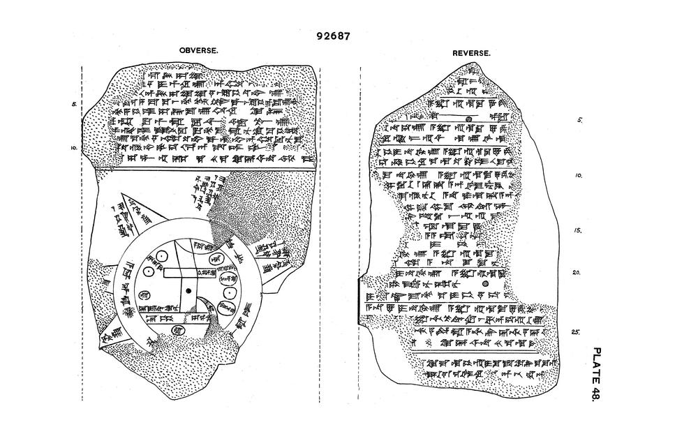
Recently I ran into this Late Babylonian map of the world on a clay tablet from the British Museum:

The map shows the world as a disc surrounded by the circular “Bitter River”. Babylon is marked as a rectangle, the river Euphrates flows south in the middle, and small circles show cities or districts.
The curator’s comment in the BM catalog says that according to the tablet it was copied from an earlier one. Clearly there was an established practice by 6th c. BCE—this object is quite recent in Mesopotamian terms, after all.
Obviously, the map was meant to be more conceptual than realistic. However, there are many notes (and even some time / linear measurements) which make it more usable. (Please visit BM and read the item description; it’s quite fascinating.)
What an intriguing map, isn’t it?
As the fragment is approximately 12 by 8 cm (approx. 3″ x 5″), it’s believable that it could’ve easily been transported if desired. Which makes it quite plausible that intrepid adventurers in a story or role-playing campaign in a similar setting could carry around maps made in the same style. There could quite well be professional mapmakers and a developed cartography for your world, even if writing doesn’t happen on sheets of paper as we know it.
Images: The Trustees of the British Museum (CC BY-NC-SA 4.0)
The Visual Inspiration occasional feature pulls the unusual from our world to inspire design, story-telling, and worldbuilding. If stuff like this already exists, what else could we imagine?

Objects like this are fascinating. We so rarely get any idea of how ancient people conceptualized physical space on a larger scale than could be observed in person.
LikeLiked by 1 person